Occassional thoughts about orienteering
| okansas.blogspot.com Occassional thoughts about orienteering |
|
Tuesday, October 24, 2006 New Project? Mountain Bike O' Map? I spent a couple of hours on Sunday exploring an area that has some potential to be a new orienteering area. I'm thinking that I might start by mapping it as a mountain bike O' area. I spent a couple of hours on Sunday exploring an area that has some potential to be a new orienteering area. I'm thinking that I might start by mapping it as a mountain bike O' area.Although the area is small, I think it'd make for a nice short or sprint course area, and even then you'd probably have to have a map change. What would make the area good for mountain bike O' is that there is a dense network of bike trails. Most of the trails are smooth single track, but there is also a large paved trail through the entire area. The forest is typical for the KC-area. A few areas are nice, open forest (see the photo below). But, most of the forest is thick (and some of it is very thick). Old farm fields make up a fair chunk of the area. But, it looks like the farm fields aren't going to be maintained by burning or mowing. They're already getting overgrown with dense tall grass. Fortunately, the dense trail network would mean an orienteer wouldn't be forced to spend time in the worst of the vegetation. The photo below shows one of the nicer hillsides with open forest and beautiful fall colors. The photo at the top of the page shows the paved bike trail in the background. 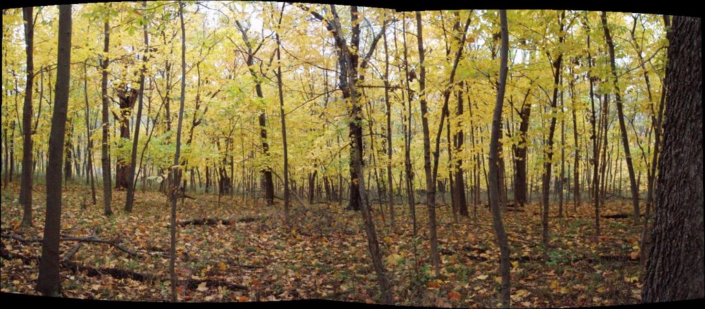 Here is the map I carried when I explored the area. The contours are from USGS with many of the bike trails added. The map is superimposed over a air photo that gives you an idea of the mix of fields and forest. 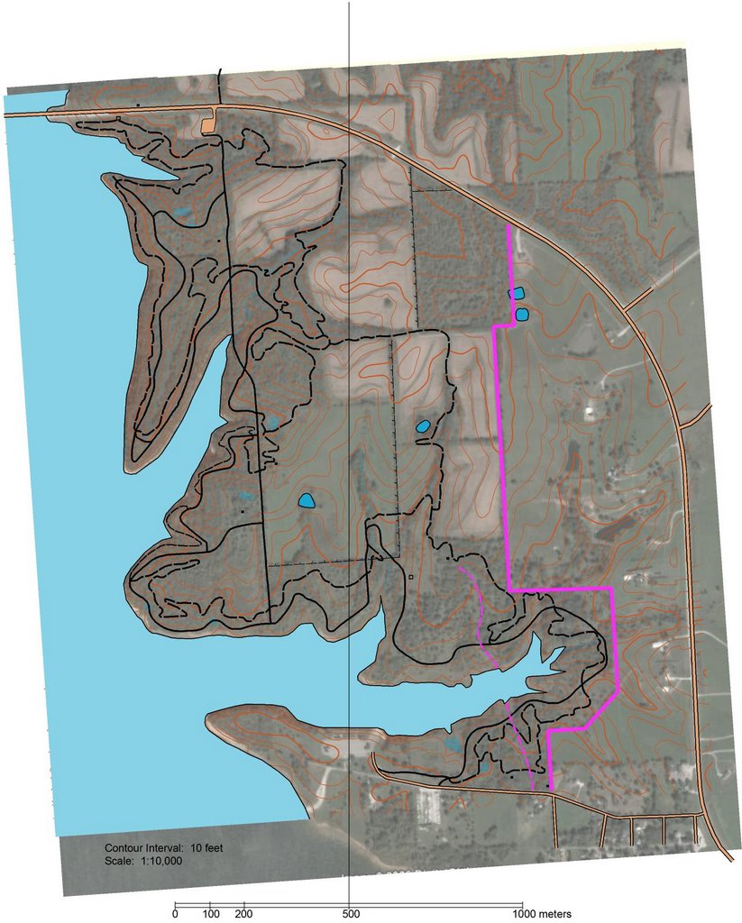 posted by Michael |
8:32 PM
posted by Michael |
8:32 PM
Comments:
Looking at Hammer's MTB O-map and what we have locally - the route choices look less complex here. Route choices are further apart. It's also mostly single track. And is there the rule in bike O you can't not get off the tracks? Looking forward to trying out your map.
Patrick, Kevin from PTOC created it. I don't know the details, but he used USGS contours. The photo is from Google Earth, I think. The trails are from a mountain biker who used a GPS to get the tracks. Kevin used OCAD. If you haven't played with OCAD, you should. You can get a trial version with some limits from www.ocad.com
Gene, Yeah, Hammer's area looks a bit more interesting. But, I think the Smithville area is quite good (just a bit small). As far as I know you can leave the trails, but I think MTB O' rules require that you always have your bike with you. So, leaving the trails is rarely a good option. You should come to KC some weekend and we can explore those trails on bike and/or on foot.
Hammer--where is that? Horseshoe Resort? And are those trails darker/thicker than a normal map? How many races have you had there?
Post a Comment
# posted by
 : 7:46 AM : 7:46 AM |
|
||||
|
|
|||||